Public Map – Symbology

Public Map began as a pilot, multi-partner research project to co-design a digital mapping platform with and for young people and communities across Anglesey (Ynys Mon). It has now been funded for its next phase, expanding its reach across various locations in the UK, including Cardiff, Pontypridd, Cambridge and Wrexham.


Play:Disrupt won a TET Inspire Future Generations 2025 award in Material resources and research for our symbology work as part of the Public Map. The award was a joint win with Dinah Bornat of ZCD Architects, for her book All to play for: How to Design Child Friendly Housing. 

Background:

Funded by AHRC and led by Cambridge University, the Public Map research project aims to empower communities by integrating diverse voices into spatial data, enhancing decision-making and resource allocation.

The project has been running since early 2024 and Play:Disrupt are working as creative engagement co-investigators within a large, multidisciplinary research team. Together, and with a huge range of citizen participants on Anglesey (Ynys Môn yn Cymraeg) we are developing a digital mapping system that more deeply engages local communities, communicates the value of community assets and can be used by local authorities to inform their work. The project is particularly focused on the views and experiences of young people and is aligned with The Well-being of Future Generations Act of Wales.

Development:

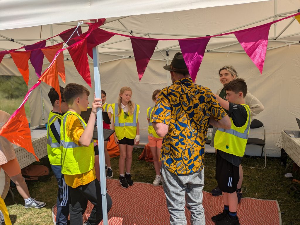
We were tasked with connecting with young people outside of traditional settings, so in-house Welsh speaker, Nia Evans set to work connecting with organisations across the island, from Barnardos Young Leaders to Young Carers, Mencap Môn and additional needs schools, youth clubs to a stint at the Anglesey Agricultural show! 

These youth and community focused workshops have enabled us to co-design and to collaborate with young people on the development of the digital platform itself. 

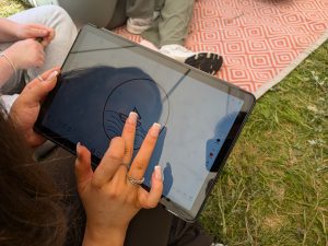
Alongside Happenings, a young person focused relational mapping tool created by project partners, Free Ice Cream (more on that in a future piece), we were invited to co-create a new symbology with young people. Tapping into our love of loose parts, narrative and an eye-catching prop, our designer Kerry created a Mandala of Ynys Môn to hold materials and inspire wonder. 

Delivery

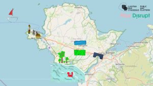
The design of the Public Map Platform is very much rooted in Wales and more specifically Anglesey – in its people, places,  policy and legislative landscape. 

Young people created maps of where they play and together we drew out commonalities to find themes such as Calm, Adventure and Danger, which in turn they created symbols for. As the mapping platform developed, it created space to upload animated gifs and a further round of workshops allowed participants to create these moving icons and cast them onto the digital map of their land. The impact of children seeing their creations appear on a digital map was beautiful. 

Our playful workshops create engaging, accessible, and joyful experiences for young people—essential in fostering meaningful connections with this demographic. These skills are fundamental to nurturing hopeful, supportive, and regenerative communities, shaping a brighter future for the next generation.

‘An innovative long-term project which gives children authorship over how to communicate via symbols and maps to reflect their feelings and aspirations for public spaces. The team made the process inclusive and represented voices which might ordinarily be missed.’

Judging panel for the Thornton Education Trust’s Inspire Future Generations awards 2025

‘It’s brilliant work, really novel and genuinely co-designed with young people. I don’t think anyone has done anything like it before!’

Professor Scott Orford, co-investigator for Public Map and WISERD (Wales Institute of Social and Economic Research and Data) Co-Director, Cardiff University

Future:

Moving forwards, the project will continue to empower children and young people by actively involving them in decision-making about their communities. A key focus is creating and sharing collaboratively created maps, ensuring local voices shape the future of their spaces, and that local communities can benefit from providing and accessing their data.


The project has helped us to develop new relationships in North Wales and we were commissioned to develop a toolkit to support community councils to engage young people in the design of play spaces as well as stand alone engagements for other parties to connect young people’s views into decision making. The connections allowed us to run workshops looking at climate adaptation with Mencap Mon and later this year we will be delivering training for Adnodd – a welsh curriculum service. Building roots a few hundred miles away has really drawn us into the island and it is heart warming to see that the good work is reflected in new commissions.


Additionally, we aim to support local authorities across the UK in transitioning to a digital, map-based planning system—transforming community consultation and significantly enhancing public engagement.


For our research partners, Cambridge University, Cardiff University, Wrexham University, the Quality of Life Foundation, Feral Ventures and Dotiau, our ability to engage young people in accessible, joyful ways has been vital to the success of the project.

Here is a video showing a young person talking us through a digital map he has made, featuring symbols animated by his peers:

Share This Project